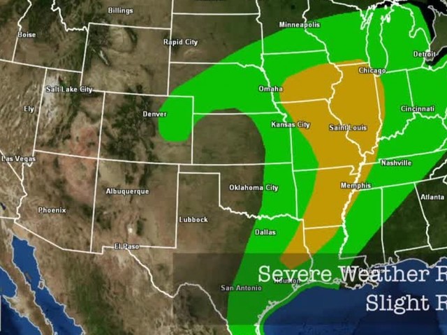
The calendar says November, but that doesn't mean it's too late for severe thunderstorms.
The severe weather bulls-eye covers parts of Iowa, Missouri and Illinois.
Thunderstorms will begin to fire near the low pressure system and along the cold front this afternoon, lasting into the evening.
DOWNLOAD STORM SHIELD FOR THE LATEST WATCHES AND WARNINGS
Strong, damaging winds are the primary threat, but a few tornadoes can't be ruled out, especially where Iowa, Missouri and Illinois meet. Large hail is also a threat, but that's mainly limited to central Iowa.
Regardless of severe weather, nearly everyone in the risk area will experience strong, borderline severe winds.
This particular low pressure system is a strong one, having quickly developed in Colorado and causing blizzard conditions there.
It hasn't weakened in the last 24 hours, and winds are still whipping around this low at speeds up to 40 and 50 mph.
Fortunately, tomorrow will be a quieter weather day, and everyone will be able to assess what Mother Nature deals us today.


