Before last week, severe weather had been on a really long vacation. This year was shaping up to be the slowest start to severe weather season on record.
That was before last week.
The United States saw four severe weather day days in a row as March went out like a lion and April kept roaring like one.

The counts of wind damage, hail reports and tornado sightings all nearly doubled as Mother Nature grumpily rolled out of bed from her long slumber.
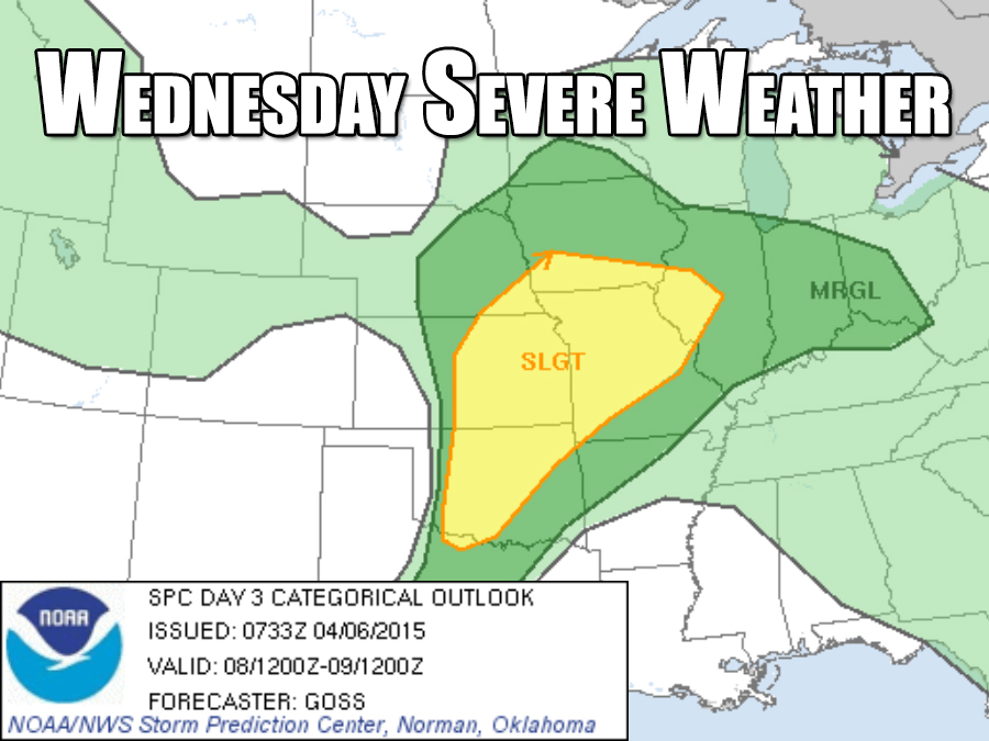
While this week is shaping up to be much quieter, things are still going to get noisy by the middle of the week when the potential for more severe thunderstorms returns on Wednesday to the middle of the country.

That same chance for nasty thunderstorms looks like it'll even stick around and move slightly east on Thursday.
This pattern will likely continue through the middle of the month while warm, moist air - two of the main ingredients for severe thunderstorms — returns to most of the country.
In the meantime, it's best to keep a close eye on forecasts for the next round of severe weather.


