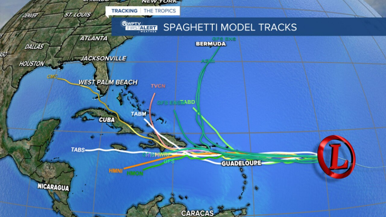
WEST PALM BEACH, Fla. — Tropical Depression Seven formed Wednesday morning in the central Atlantic Ocean and is expected to strengthen into Tropical Storm Fiona in the next day or so.
According to the 5 p.m. update from the National Hurricane Center, the depression is located about 745 miles east of the Lesser Antilles and is moving west, packing maximum sustained winds of 35 mph.
Tropical Depression 7 has formed, here’s the latest forecast track. pic.twitter.com/4NFalhhiOV
— John Gerard (@JGerardWeather) September 14, 2022
TRACKING THE TROPICS: Hurricane Center | Hurricane Guide
The NHC said the depression is expected to move through the Leeward Islands on Friday or Friday night, then be near the U.S. Virgin Islands and Puerto Rico this weekend.
The system is expected to further strengthen into a tropical storm Wednesday night or Thursday. If that happens, the storm will get the name Fiona.
According to the latest forecast track, the storm will likely weaken back to a depression once it passes over Hispaniola on Monday, before turning to the north and northeast.
"The long-range computer models take it just to the east of the Bahamas," said WPTV First Alert chief meteorologist Steve Weagle. "We'll have to monitor this one, but at this point, it looks like it will stay to the east of our area."

The NHC said that, regardless of development, the system will likely bring gusty winds and heavy rainfall to parts of the Leeward Islands on Friday and Saturday.
"It does have a lot of wind shear to battle ahead of it," said WPTV First Alert meteorologist Steve Villanueva.
Although this is the relative peak of the Atlantic Hurricane Season, there have only been five named storms and two hurricanes so far this year.
Typically by this time of the season, there would have already been eight named storms and three hurricanes.


