
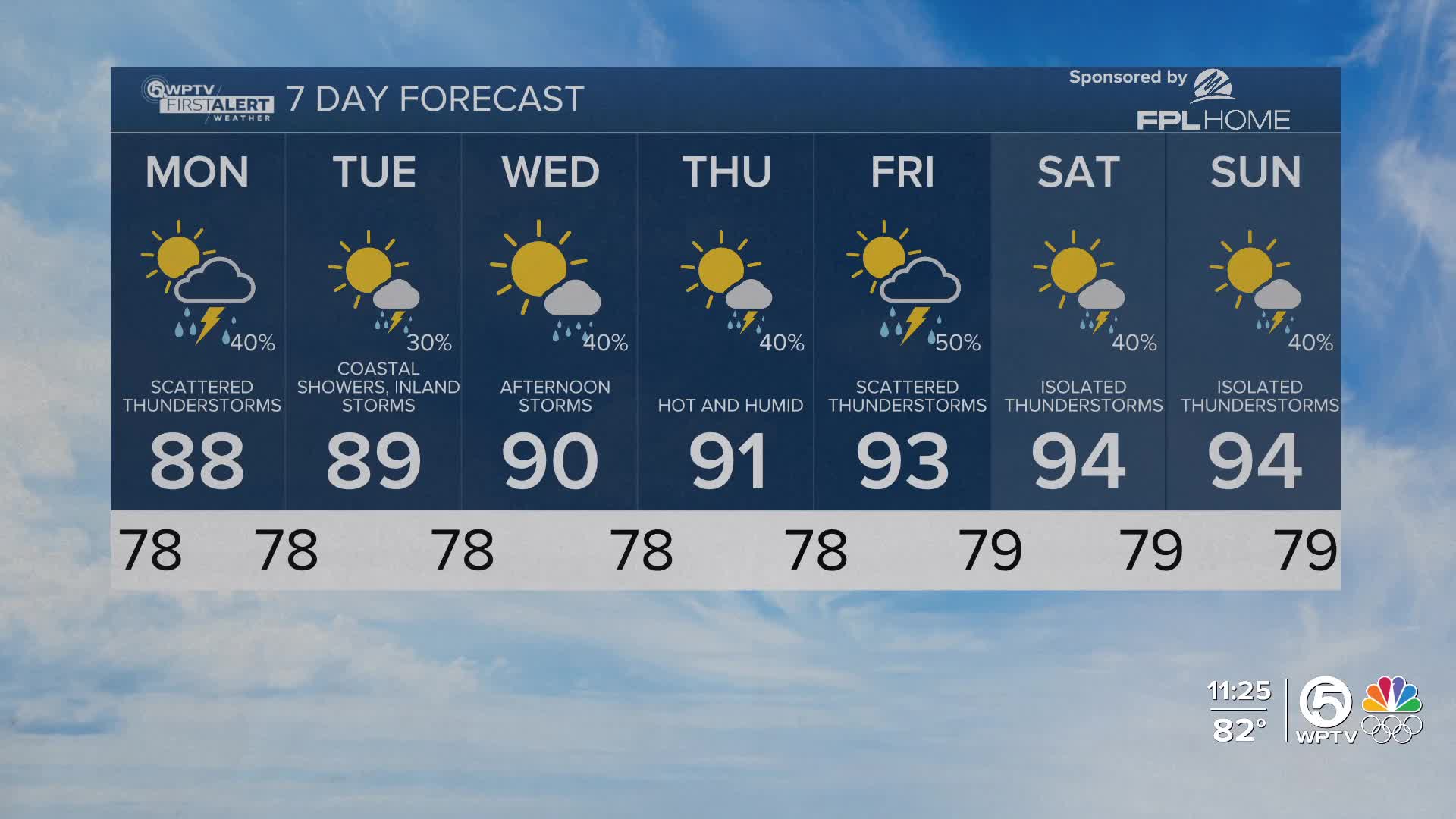


WEST PALM BEACH, Fla. — Wake-up temps Monday morning start in the upper 70s near the coast and lower 70s well inland
South Florida stays on edge of an area of high pressure located off the coast of Carolina which
continues our easterly flow and low level moisture moving across the area.
MORE WEATHER: Radar | Alerts | 7-Day Forecast | Hourly Forecast
Our current pattern remains basically unchanged as we head into Monday with a 40% chance of scattered showers/storms with plenty of daytime heating and moisture in place
Temps Monday range from the mid 80s near the coast to the low 90s over the interior
By middle portions of the work week - we return to a more typical pattern with lighter east flow. Highest rain chances stay near the coast in the early morning and then shift inland and interior during the afternoon and evening
By Friday - a front pushes into northern Florida and is expected to push south to central Florida by next weekend causing our winds to be southwesterly
This front may provide more instability by the end of the week into the weekend - increasing our rain chances - however we will need to monitor the progress of the front to see how exactly it will impact our weather
Temps warm through the workweek. By next Saturday - we're looking at temps in the low to mid 90s at the coast and upper 90s inland
Boating conditions will be improving - with seas around 2 feet Monday.
A high risk of rip currents continues at local beaches to start the workweek


