


WEST PALM BEACH, Fla. — Clouds will also linger overnight and it will feel a bit muggy out. Lows will only fall into the lower 70s across the area.
MORE WEATHER: Radar | Alerts | 7-Day Forecast | Hourly Forecast
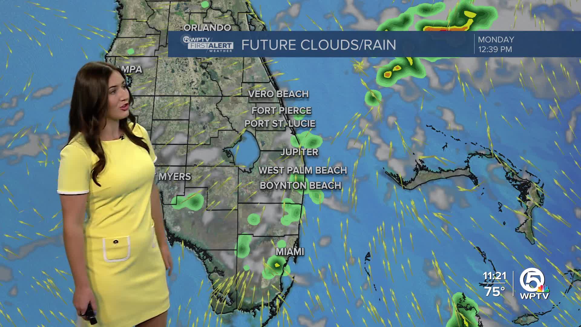
Monday will be warm and muggy with mainly cloudy skies. Isolated, light showers are possible in the morning, but there will be higher rain chances with more coverage in the afternoon-evening. High temperatures stay in the mid-80s.
We will look for another round of showers to storms to develop across the area on Monday afternoon. We are under a marginal threat for strong to severe storms again. Frequent lightning and damaging wind gusts near 40+ mph will be our greatest concern.
Rain may linger well into the evening, with the last of it wrapping up after dusk. We desperately need the rain due to extremely dry spots on the drought monitor.
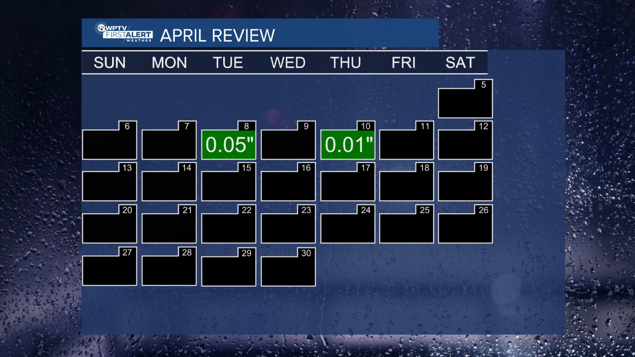
We had the fifth driest April on record, with only 0.06 inches of rainfall recorded at Palm Beach International Airport.
Starting Tuesday, we will be getting a hint of summertime. You can expect hot and very humid weather for most of the work week.
Highs in the middle to upper 80s Tuesday through Friday with partly cloudy skies. Lows will be in the lower 70s. Unfortunately, there won't be a sense of relief from the humidity anytime soon.


