
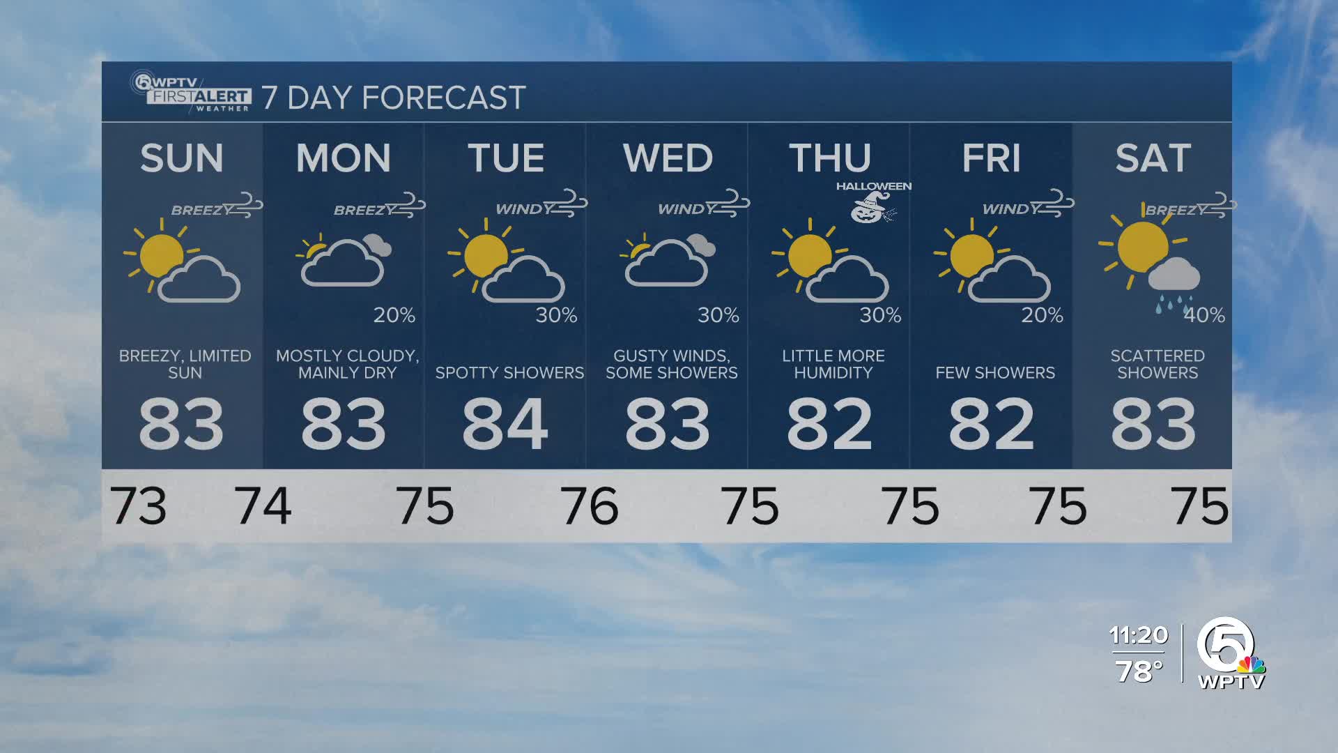


WEST PALM BEACH, Fla. — High pressure in control of our weather will give us a dry day for Sunday with nothing more than an isolated stray showers.
Wake-up temps Sunday range from the mid 60s far inland to the mid 70s at the coast.
Afternoon highs expected to warm in the low to mid 80s. Humidity drops just a bit for Sunday with dewpoints in the 60s.
Winds will be breezy from the northeast on Sunday with higher wind gusts expected into the workweek.

We continue to have a high rip current risk across the east coast, so please be cautious in the ocean. If you are caught in a rip current, remain calm and swim parallel to shore until you feel the release of the rip current.
MORE WEATHER: Radar | Alerts | 7-Day Forecast | Hourly Forecast
Monday will stay mainly dry with shower chances picking up on Tuesday due to gusty winds as a weak front passes through and a deepening trough.
Due to the set up of the high pressure system and weak front, rain chances will increase with coastal showers expected Tuesday through Friday.
These showers will be quick-movers and will not amount to much significant rain.
In the tropics: We're watching the SW Caribbean Sea for possible tropical development by mid-week. A broad area of low pressure is expected to form and gradual organization is possible through the end of the week as it drifts NE over the SW Caribbean Sea.
This highlighted area has a 20% chance of developing in the next 7 days. We will keep you posted - as of now - most models steer this to the east of South Florida.


