


WEST PALM BEACH, Fla. — A hot and humid day with highs in the upper 80s to near 90 with heat indices near the triple digits. The upper level ridging will keep us hot, hazy, and humid.
Sunday night will be calm with partly cloudy skies, waking up to temperatures in the 70s.

MORE WEATHER: Radar | Alerts | 7-Day Forecast | Hourly Forecast
Storm chances stick around on Memorial day as well as the heat.
High temperatures reach 90 with heat indices near the triple digits again. We are currently not under a severe weather risk, but be cautious.
Isolated showers to storms are possible near the late morning into the late afternoon along the coast. The evening is trending drier than most.
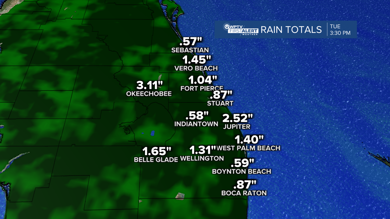
Tuesday will be isolated showers and storms. It will be more inland due to the sea breeze setup. High temperatures will still be scorching in the upper 80s to near 90.
Wednesday will be similar to Tuesday with isolated storm chances. The heat is not letting up anytime soon despite the storm chances. The upper level ridge that is developing from the high pressure keeps conditions steamy and hot.
Storm chances increase significantly on Thursday. Look for scattered storms across South Florida. Some will be strong to severe with damaging wind gusts and potential of hail.

Friday will be another rainy day with scattered storms. Rainfall totals are looking pretty health by the time Friday is here. Some areas will have experienced close to 2-3" of rainfall.


