


WEST PALM BEACH, Fla. — No new heat advisories have come in for Wednesday from the National Weather Service.
Tonight, it's partly cloudy skies with lows in the upper 70s-low 80s.
Tomorrow, isolated rain near the coast in the morning with scattered- numerous afternoon-evening showers and storms. Highs in the low-mid 90s. Some heavy rainfall is possible with flooding a concern in some isolated areas.
MORE WEATHER: Radar | Alerts | 7-Day Forecast | Hourly Forecast
Thursday, highs in the low-mid 90s with more scattered showers and storms. Heavy rainfall and flooding again a threat.
Friday, highs in the low-mid 90s with afternoon-evening showers and storms.
For the weekend, Saharan dust pushes in and skies become hazy. Scattered showers and storms are still possible with most of the rainfall pushing inland later in the day. Highs in the low 90s.
Early next week, highs in the low 90s with hazy skies and less storms around, mainly inland.
The National Hurricane Center is tracking three areas of concern in the Atlantic.
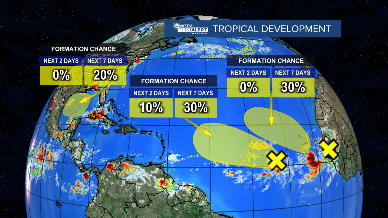
One wave a few hundred miles west-southwest of the Cabo Verde Islands is interacting with a larger trough of low pressure, and continues to produce disorganized showers and thunderstorms. Formation chance through seven days is 30%.
Another wave along the west coast of Africa is producing a large area of showers and thunderstorms. Environmental conditions are expected to become unfavorable for development by early next week. Formation chance through seven days is 30%.

And Tuesday night, the NHC noted a broad area of low pressure could form in the central or western Gulf of Mexico by the beginning of next week. Some slow development of this system is possible as it moves generally westward, potentially nearing the western Gulf of Mexico coastline in about a week. Formation chance through seven days is 20%.


