


STEINHATCHEE, Fla. — Debby made landfall as a hurricane Monday morning in Florida’s Big Bend as a Category 1 storm with maximum sustained winds of 80 mph.
The storm was downgraded to a tropical storm after making landfall and is moving inland near the Florida /Georgia border, bringing a major flood threat to the area over the next several days.

Maximum sustained winds have decreased to near 50 mph with higher gusts. Additional weakening is forecast through late Tuesday. Some restrengthening is possible on Wednesday and Thursday, the National Hurricane Center said.

National News
Tropical Storm Debby blamed for at least 4 deaths as rain drenches East Coast
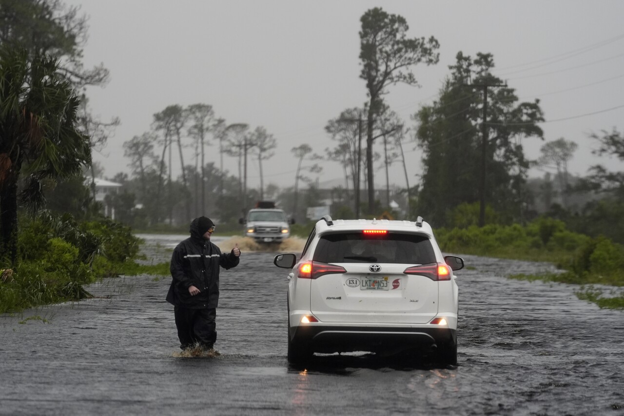
The storm made landfall as a Category 1 storm near Steinhatchee, a tiny community in northern Florida of less than 1,000 residents on Florida’s Gulf Coast.
It had maximum sustained winds of 75 mph and was moving north-northeast at 10 mph, the National Hurricane Center in Miami said.
Storm surge was expected to be the biggest threat for Florida, with 6 to 10 feet of inundation above ground level predicted in part of the zone near the Big Bend, according to John Cangialosi, a hurricane specialist with the National Hurricane Center.
“That part of the coast is a very vulnerable spot,” Cangialosi said Monday.
Some areas, including Sarasota and Manatee counties, have already received 10 to 12 inches of rain.
Nearly 214,000 customers were without power in Florida on Monday morning, according to PowerOutage.com. In Marion County, which is inland and south of Gainesville, sheriff’s officials noted in a Facebook post Monday that crews were responding to reports of downed power lines and trees that have fallen on roadways and homes.
Gov. Ron DeSantis said some 17,000 linemen are working to restore electricity. He warned residents in affected areas to sit tight until conditions are safe.
In Sarasota, the city's parks and recreation department said they're dealing with flooding, and roads are impassable to due to the heavy rains brought on by Debby.
TRACKING THE TROPICS: Hurricane Center | Hurricane Guide
Debby will move into southern Georgia Monday night, then turn easterly and begin to slow down near the Atlantic Coast.
Debby will meander over the South Carolina and Georgia coasts.
Rainfall amounts will be significant and dangerous flash flooding is a high risk. 10 to 20 inches of rain are forecast to fall over between the northern coast of Georgia and the southern coast of South Carolina.

Hurricane-force winds on Monday morning extend outward up to 45 miles from the center, and tropical storm-force winds extend outward up to 140 miles.
There's a lot of uncertainty after five days out in the track for Debby. The GFS (American) model shows Debby moving back westward and into North Florida, but the EURO (European) model has Debby moving inland, then northward toward the northeast as it gets grabbed by a front.


