


WEST PALM BEACH, Fla. — A stationary front with lots of moisture over our area will once again help trigger scattered storms as we head into Thursday afternoon.
The main impact of these storms is heavy rain that could cause localized flooding and lots of lightning. Also, a strong storm is possible, although the severe threat remains very low.
MORE WEATHER: Radar | Alerts | 7-Day Forecast | Hourly Forecast
Rain chances will start to taper off on Friday. High temperatures in the upper 80s are expected through the weekend
The first day of fall is Saturday, and so far, rain chances will be much lower by then with a little less humidity.
Scattered storms then return for next week.
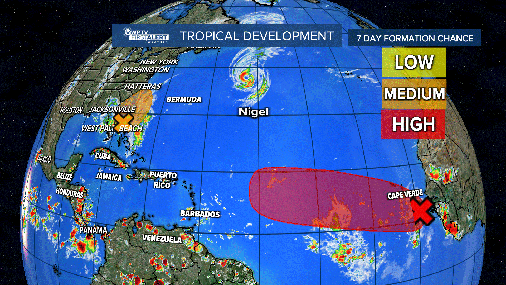
In the tropics, Hurricane Nigel is dealing with stronger wind shear and will move over cooler waters, so weakening is expected. It will stay over the open waters of the central Atlantic Ocean. Nigel is forecast to become a post-tropical cyclone by Friday.
Nigel had maximum sustained winds of 90 mph and was moving north-northeast at 25 mph. Nigel was about 550 miles east-northeast of Bermuda.
A tropical wave located a couple of hundred miles south-southeast of the Cabo Verde Islands islikely to become a tropical depression late this week, or maybe Tropical Storm Ophelia this weekend. Formation chance through seven days: 70%.
A non-tropical low will develop off the southeastern U.S. coast late this week. It may acquire subtropical characteristics as it moves north. It has a 40% chance of developing in the next seven days. This low will actually help bring some drier air to the south this weekend.


