


WEST PALM BEACH, Fla. — One last round of downpours and thunderstorms will rumble across Palm Beach County and the Treasure Coast late tonight.
There is a slight chance of some severe weather out of this, mainly in the form of gusty winds.
MORE WEATHER: Radar | Alerts | 7-Day Forecast | Hourly Forecast
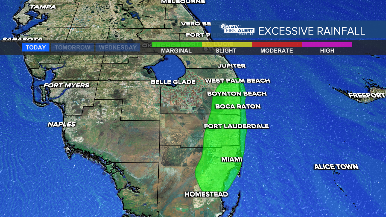
Isolated areas of flash flooding are possible as well, especially east of I-95 where there's a lot of roads and concrete. Otherwise, it's much needed rain in what has been an extremely dry weather pattern for south Florida.
A leftover shower is possible very early Tuesday morning, but the heaviest is long gone by the time the morning commute gets underway. Overall, Tuesday is a pretty nice looking day with highs in the mid 70s.
The rest of the week is quiet with high pressure building into the area.
Although as the winds begin to veer, a couple of spotty showers can't be ruled out Wednesday and Thursday.
Over the weekend it will be quite pleasant with highs in the middle 70s under mostly sunny skies.


