


WEST PALM BEACH, Fla. — The outer bands from Hurricane Helene are affecting our area and we'll continue to see locally heavy downpours on Thursday.
Any of those outer bands could produce an isolated tornado as well.
Otherwise, we'll have winds of 20 to 30 mph with periods of locally heavy rainfall.
MORE WEATHER: Radar | Alerts | 7-Day Forecast | Hourly Forecast
The NHC has placed Palm Beach, Martin, St. Lucie, Indian River, and Okeechobee counties under a tropical storm warning, meaning tropical storm conditions are expected somewhere within the warning area within the next 36 hours.
In addition, Palm Beach County is under a flood watch.

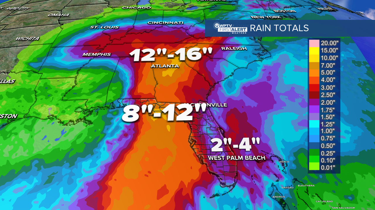
Overnight, the outer bands continue to affect South Florida, and the rain could be quite heavy. We'll end up with roughly two to four inches of rainfall before all is said and done.
Thursday will be the windiest day as the center of Helene will be roughly 300 miles to our west.
By Thursday night, Helene is pushing into the Big Bend area of Florida. At that point, we're on the south side of that storm.

For Friday, still a lot of tropical moisture moving across South Florida. It's not as windy, but still quite breezy.
Scattered storms will continue into the weekend, too.
Read more of WPTV's coverage of Hurricane Helene below:

Tropical Weather
Palm Beach Co., Treasure Coast schools closed Thursday

Tropical Weather
COUNTY-BY-COUNTY IMPACTS: What to expect

Hurricane
HURRICANE HELENE: Palm Beach Co., Treasure Coast under Tropical Storm Warning

Hurricane
Steve Weagle: Here's what you need to know about Helene

Hurricane
'Cautiously optimistic': Wellington prepping for potential flooding

Hurricane
'WAITING AND WATCHING': Belle Glade, South Bay preparing for impacts of Helene

Hurricane


