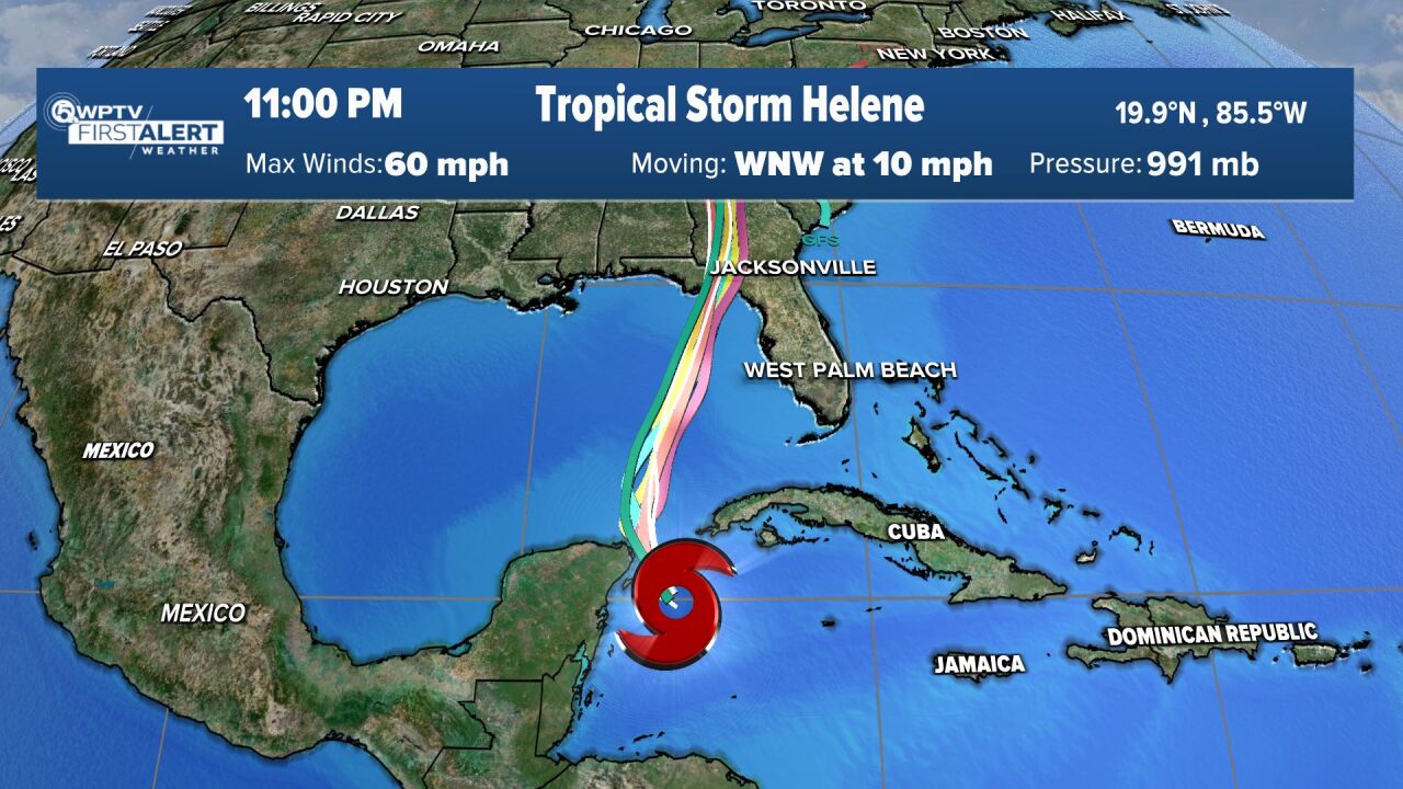
WEST PALM BEACH, Fla. — Tropical Storm Helene formed Tuesday near Cuba and is expected to strengthen into a major Category 3 hurricane before making landfall in Florida's Big Bend region on Thursday.
In its 5 a.m. update, the National Hurricane Center included Palm Beach County in a tropical storm warning. Martin, St. Lucie, Indian River and Okeechobee counties are also under a tropical storm warning.
"It just means it's getting a little closer number one, and still a bit more confident we are going to see tropical force conditions," WPTV First Alert Weather meteorologist James Wieland said.
The system now has maximum sustained winds of 60 mph and is moving to the west-northwest at 10 mph.

TRACKING THE TROPICS: Hurricane Center | Hurricane Guide
By Wednesday, Helene will work its way into the southern Gulf of Mexico and strengthen into a Category 1 hurricane with winds of 74 mph.
Then as it works its way toward the north and across very warm Gulf waters, it's expected to rapidly intensify into a major Category 3 hurricane with maximum sustained winds of 115 mph.
The center of the storm will stay roughly 300 miles to the west of West Palm Beach.
The Big Bend region and parts of the Florida Panhandle are under a hurricane warning.

Our viewing area will feel impacts from Helene between Wednesday and Friday.
We'll start to see the outer bands on Wednesday as storm moves into Gulf. That will continue into Thursday with the threat of severe weather, gusty winds, and heavy downpours.
"These outer bands may spin up a tornado locally, plus produce anywhere from two to five inches of rain," WPTV First Alert Weather meteorologist Steve Villanueva said. "The storm is gonna stay roughly 300 miles to the west, but it will kick up those winds. We could have winds of 40 to maybe 50 miles per hour."
By the weekend, storm chances will drop to more seasonal levels.


