TAMPA, Fla. — Gov. Ron DeSantis emphasized that Wednesday is a critical day for residents across Florida as Hurricane Helene gains strength and closes in on the state.
"Today is the day to finalize your preparations and to put your plan in place. So please do so," DeSantis said during a news conference at TECO Energy in Tampa. "Take this seriously and make sure that you're looking out for yourself and your family."
WATCH: Gov. Ron DeSantis gives update on Tropical Storm Helene
TRACKING THE TROPICS: Hurricane Center | Hurricane Guide
DeSantis said 61 counties — outside of several in southeast Florida, including Palm Beach, Martin, St. Lucie, and Indian River counties — remain under a state of emergency, which allows state officials to make resources available to communities ahead of any potential storm impacts.
Okeechobee County is the only county in our viewing area included in the emergency order. There are currently no evacuation orders for our local counties.
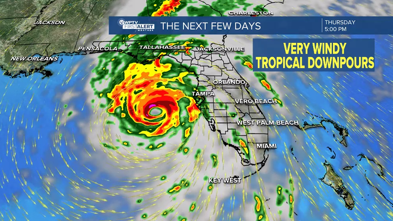
Helene is expected to strengthen into a major Category 3 hurricane before making landfall in Florida's Big Bend region on Thursday night.

The NHC has placed Palm Beach, Martin, St. Lucie, Indian River, and Okeechobee counties under a tropical storm warning, meaning tropical storm conditions are expected somewhere within the warning area within the next 36 hours.
In addition, Palm Beach County is under a flood watch.

While the center of the storm will stay roughly 300 miles to our west, DeSantis warned that Helene will impact the entire state, including the possibility of tropical storm force winds in South Florida.
"This is a very big storm. You're gonna have impacts that are far outside of what a spaghetti model would have or what a cone would have," DeSantis said.
Ahead of Helene's arrival, DeSantis said tens of thousands of utility workers are mobilized and ready to respond to any storm-related outages.
"We continue to have thousands of lineman pouring into the state. They're being amassed," DeSantis said. "And then obviously, once the storm passes, they will go and work on storm restoration."

For South Florida, the heaviest downpours will likely be between Wednesday afternoon and into Thursday morning.
"As we head into Thursday, most of the heaviest downpours will stay along the Gulf coast, and for us it's going to be more scattered about," WPTV First Alert Weather meteorologist Steve Villanueva said.
The outer rain bands may spin up a tornado locally and possibly produce two to five inches of rain. And even though Helene will stay roughly 300 miles to our west, the winds can still kick up here locally between 40 to maybe 50 miles per hour.

For Friday, a lot of tropical moisture will continue to move across South Florida. It won't be as windy, but still quite breezy.
By the weekend, storm chances will drop to more seasonal levels.


