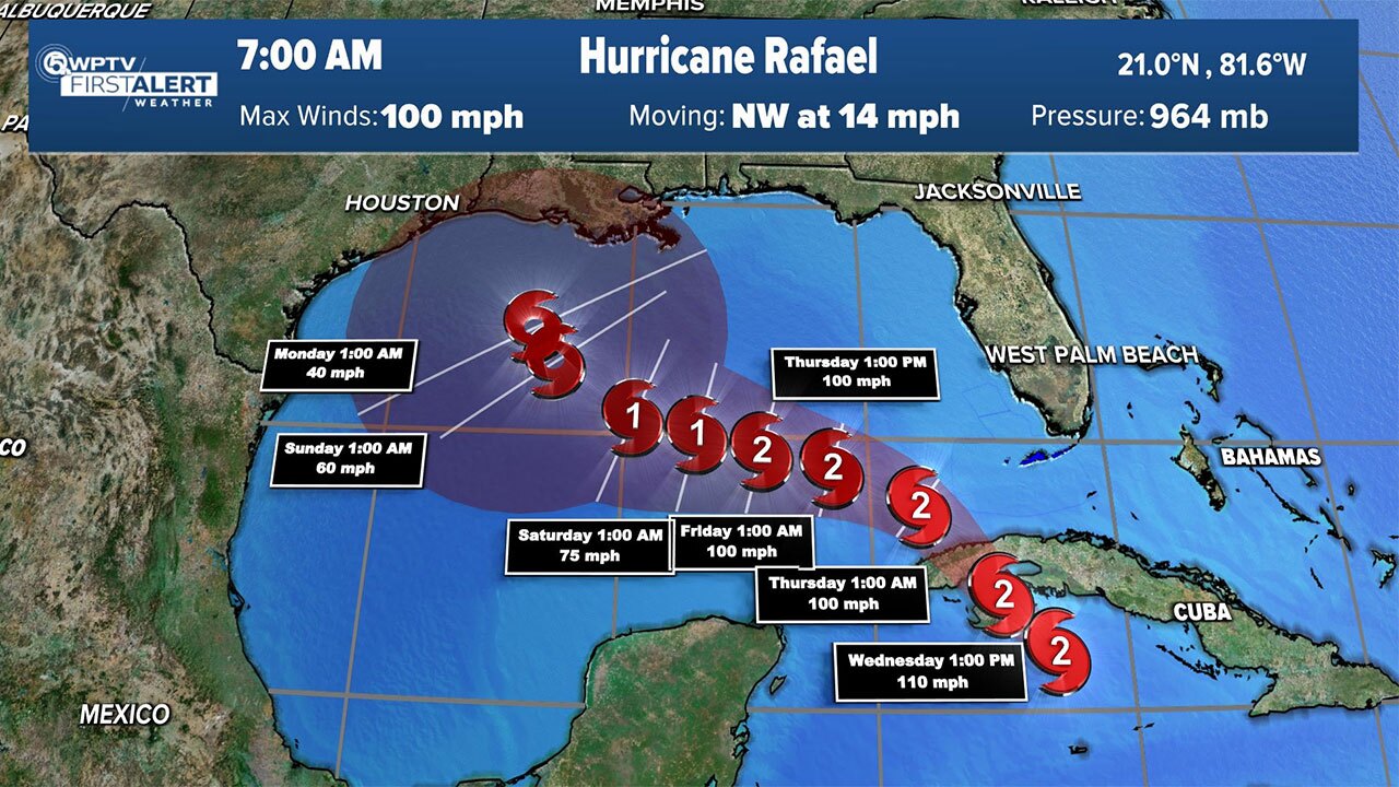
WEST PALM BEACH, Fla. — Rafael on Tuesday night strengthened to a Category 1 hurricane with winds of 80 mph and it heads toward the Cayman Islands.
A tropical storm warning is in effect for Lower and Middle Florida Keys from Key West to west of the Channel 5 Bridge.
It's expected to further strengthen as it moves through the Cayman Islands and western Cuba on Tuesday and Wednesday, then emerge into the Gulf of Mexico Wednesday night.
TRACKING THE TROPICS: Hurricane Center | Hurricane Guide
As the storm moves farther into the Gulf, conditions will start to become unfavorable and there should be some weakening before landfall (if any landfall). There's still a lot of uncertainty with the track once Rafael gets into the Gulf.

On Rafael's current track, South Florida will not see direct impacts. However, we will see some fringe effects as it will drag a tropical air mass over us, which will increase our rain chances and humidity over the next few days.
It will stay windy, too, and we could see some tropical storm wind gusts Tuesday, Wednesday and early Thursday.
Local impacts include the possibility of rainfall totals of 1 to 2 inches, but mainly in isolated areas. Thunderstorms and wind gusts of 35 to 40 mph are possible, but not directly associated with Rafael. Rough seas and some beach erosion are also possible.

The WPTV First Alert Weather team is also watching an area behind Rafael, north of the islands, that has a low chance of development at the moment.
It's expected to move into the Bahamas on Saturday, then into South Florida on Sunday.
Regardless of development, we will see wind and rain chances pick up on Sunday and Monday.


