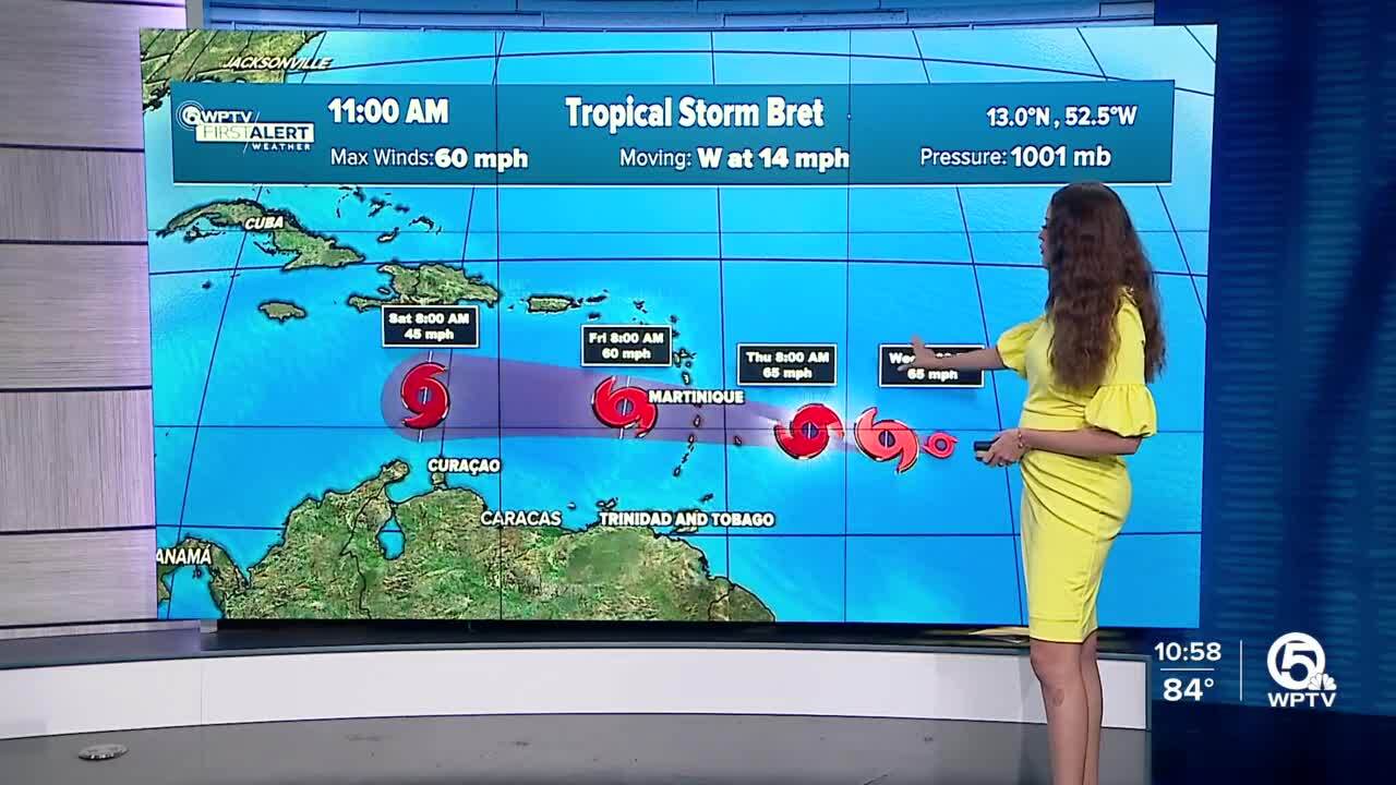
WEST PALM BEACH, Fla. — Tropical Storm Bret is now packing 60 mph winds as it continues moving west toward the Lesser Antilles, the National Hurricane Center said Wednesday.
In its 11 a.m. advisory, the NHC said the storm was moving west at about 14 mph and is expected to continue in this direction for the next several days.
The NHC said some additional strengthening is forecast during the next day or so, and Bret is expected to be a tropical storm when it reaches the Lesser Antilles Thursday and Thursday night, and the eastern Caribbean Sea on Friday.
A tropical storm watch has been issued for Barbados, Martinique, and St. Lucia.

Bret is no longer expected to strengthen into a hurricane, according to the latest update from the NHC.
"As for us, what does this mean? Well, it's obviously good news that it stays to the south of us," WPTV First Alert Weather meteorologist Jennifer Correa said. "But once the storm really starts to weaken, the moisture starts to spread out. So some of that moisture associated with Bret will eventually come our way."
TRACKING THE TROPICS: Hurricane Center | Hurricane Guide
In addition, a new tropical wave, Invest 93-L, is moving behind Bret with a chance to gradually get better organized later this week. That system has a 70% chance of formation in the next two days and a 80% chance in seven days, according to the 5 a.m. update.
The NHC said a tropical depression will likely form during the next couple of days while the system moves west at 10 to 15 mph across the eastern and central tropical Atlantic.
"Good news with this, it should stay over the open waters of the Atlantic," Correa said.


