WEST PALM BEACH, Fla. — A new tropical storm has formed in the Atlantic Basin for the first time in weeks.
TRACKING THE TROPICS: Hurricane Center | Hurricane Guide
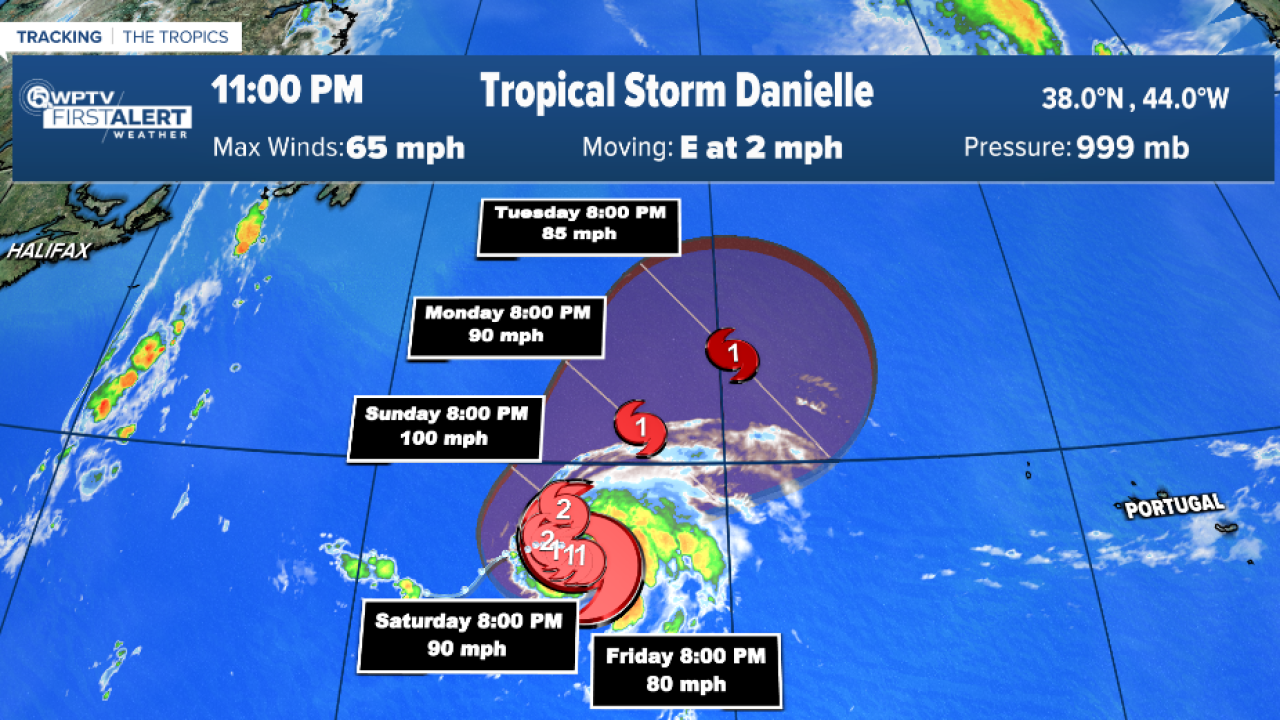
Tropical Storm Danielle formed at 11 a.m. Thursday and is moving toward the east at about 3 mph.
The tropical storm is expected to meander during the next few days.
Tropical Storm #Danielle Advisory 5: Danielle Strengthens Some More. Forecast to Become the Season'S First Hurricane During The Next Several Hours. https://t.co/tW4KeFW0gB
— National Hurricane Center (@NHC_Atlantic) September 2, 2022
Maximum sustained winds have increased to near 70 mph with higher gusts.
Strengthening is forecast during the next few days, and Danielle is expected to become a hurricane on Friday.
Tropical-storm-force winds extend outward up to 70 miles from the center. Current storm models predict it will stay away from Florida.

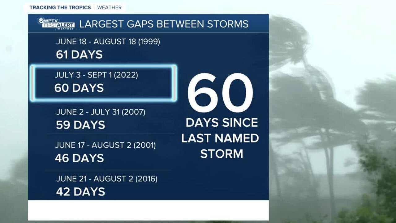
This was the first time in 25 years that there was not a named storm in August.
Since 1950, two Augusts have had no Atlantic-named storm formations: 1961 and 1997, according to Phil Klotzbach, a research scientist at Colorado State University.
There were 60 days without a named storm in the Atlantic since Colin formed in early July. This is the second longest gap between names in the Atlantic. The longest was 61 days, and that was in 1999.


