
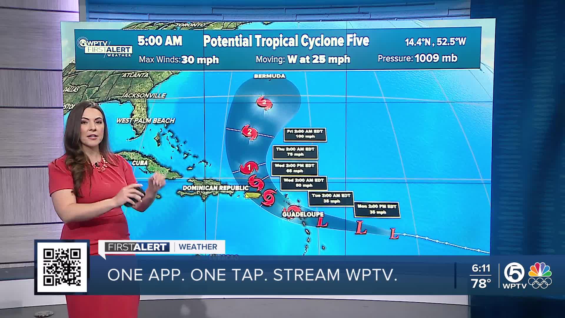


Potential Tropical Cyclone Five is working its way towards the Greater Antilles on Monday, moving swiftly at 26 mph towards the warmer Caribbean waters.
It's still very disorganized and is not expected to form into a tropical cyclone until Tuesday. The next name on the list is Ernesto.

TRACKING THE TROPICS: Hurricane Center | Hurricane Guide
It is already impacting the Leeward Islands bringing heavy rainfall and gusty winds. Tropical storm warnings remain in effect for the Leeward Islands as this system will likely become our next named storm, Ernesto.
This system will move across the Leeward Islands on Tuesday and start to shift northward. A high-pressure system and a cold front will keep the Sunshine State and the East Coast well protected from this tropical system.

As it shifts northward, it will continue to strengthen. By Thursday it is currently predicted to reach Category 1 strength and make it to a weak Category 2 by Friday.
We should expect rough waters from this system and that is about it in terms of impact for the Sunshine State.
WATCH: WPTV First Alert Weather Chief Meteorologist Steve Weagle explains the forecast


