


WEST PALM BEACH, Fla. — The WPTV First Alert Weather team is now watching three tropical waves in the Atlantic with the possibility for development over the next week.
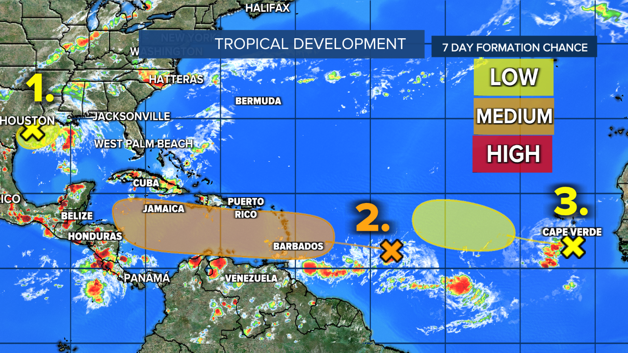
The first one in the middle of the tropical Atlantic, about halfway across, has a medium chance to develop — 40% over the next seven days — and strengthen into a tropical system over the next week or so once it gets into the Caribbean mid/late next week.
It poses no threat to land through the holiday weekend.
TRACKING THE TROPICS: Hurricane Center | Hurricane Guide
Models show it approaching the Windward Islands around late Monday/Tuesday of next week, then crossing into the Caribbean Sea most of next week and possibly strengthening by next weekend when it's near Jamaica.
After that, it's too soon to tell where it will go, but early model runs put it in the Gulf of Mexico in about 10 days.
"It'll be tracking toward the west, eventually getting into the Caribbean Sea," WPTV First Alert Weather meteorologist Jennifer Correa said. "Should stay to the south of us."
The wave behind it looks impressive on the satellite and will generally track westward over the next couple weeks.
The National Hurricane Center is giving it a low chance at the moment as it's still quite a ways away, located by the Cabo Verde Islands off the west coast of Africa.
If either of these systems becomes a named storm, it would be Francine.


