


WEST PALM BEACH, Fla. — The WPTV First Alert Weather team on Wednesday is watching two areas of unsettled weather for potential tropical development.
First, the disturbance Invest 94L in the central tropical Atlantic will arrive in the eastern Caribbean by late this week.
This area may get better organized, but that window of organization is short. The cold front that passes through South Florida on Wednesday is forecast to remain over the Gulf Stream and Cuba, and this could help keep the disturbance away from Florida.

TRACKING THE TROPICS: Hurricane Center | Hurricane Guide
"It doesn't have a good chance to further organize," WPTV First Alert Weather meteorologist Jennifer Correa said. "Most of the forecast, the spaghetti plots, end before the Lesser Antilles. That's because it might just stay as a tropical wave. Also, a front over us and to the south and east of us keeps it away from coming to Florida."
Still, the Caribbean should continue to monitor its progress.
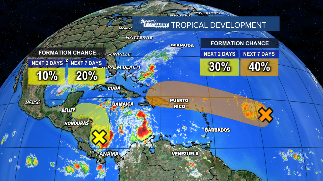
Meanwhile, a disturbance in the western Caribbean Sea has a small chance for development and will impact Central America during the next few days.
"Only has a 20% chance for development," Correa said. "Actually has a better chance once it could cross into the Pacific. But that wouldn't be an impact for us at all."
The Atlantic hurricane season officially ends on Nov. 30.


