


WEST PALM BEACH, Fla. — Storms could continue into the night with lows in the mid-upper 70s and low 70s around the lake.
From Tuesday to Thursday, a stalled frontal boundary will keep ample moisture around, triggering scattered showers and thunderstorms. Highs will be in the mid-upper 80s.
MORE WEATHER: Radar | Alerts | 7-Day Forecast | Hourly Forecast
By the end of the work week, an area of low pressure is expected to form off the Southeast U.S. coast along the stalled frontal boundary. This low has a low chance of subtropical development over the next seven days. Highs are in the mid-upper 80s with scattered storms.
Our weekend forecast will be dependent on what pans out with the area of low pressure. The closer the low, the more of an impact we will feel.
Right now, we'll hold onto the chance for scattered showers and thunderstorms with highs in the mid-upper 80s. However, if the low pulls away from us, we could be on the drier side, which would mean more sunshine and less humidity.
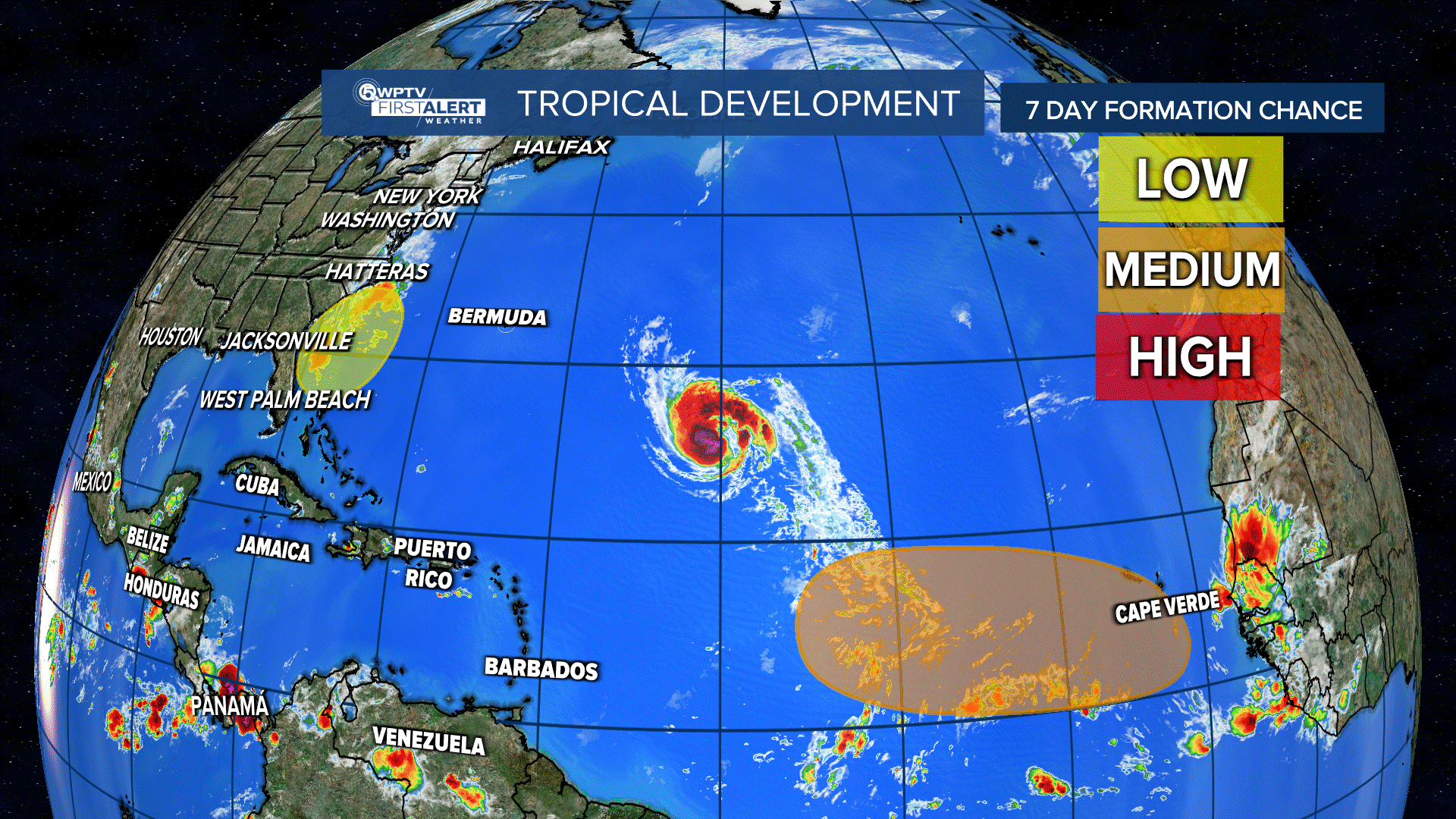
In the tropics, there is one named storm: Nigel, which became a hurricane on Monday. Nigel had maximum sustained winds of 850 mph and was traveling 12 mph northwest and about 765 miles east-southeast of Bermuda.
Nigel is expected to strengthen during the next day or so and a gradual weakening trend is forecast to begin by late Wednesday.

Also, a tropical wave is forecast to move off the coast of Africa by Wednesday. Formation chance over seven days: 70%,

And a subtropical area of low pressure is forecast to form near the southeastern coast of the U.S. this week. It could acquire some subtropical characteristics this weekend if it remains offshore. Formation chance over seven days: 30%.


