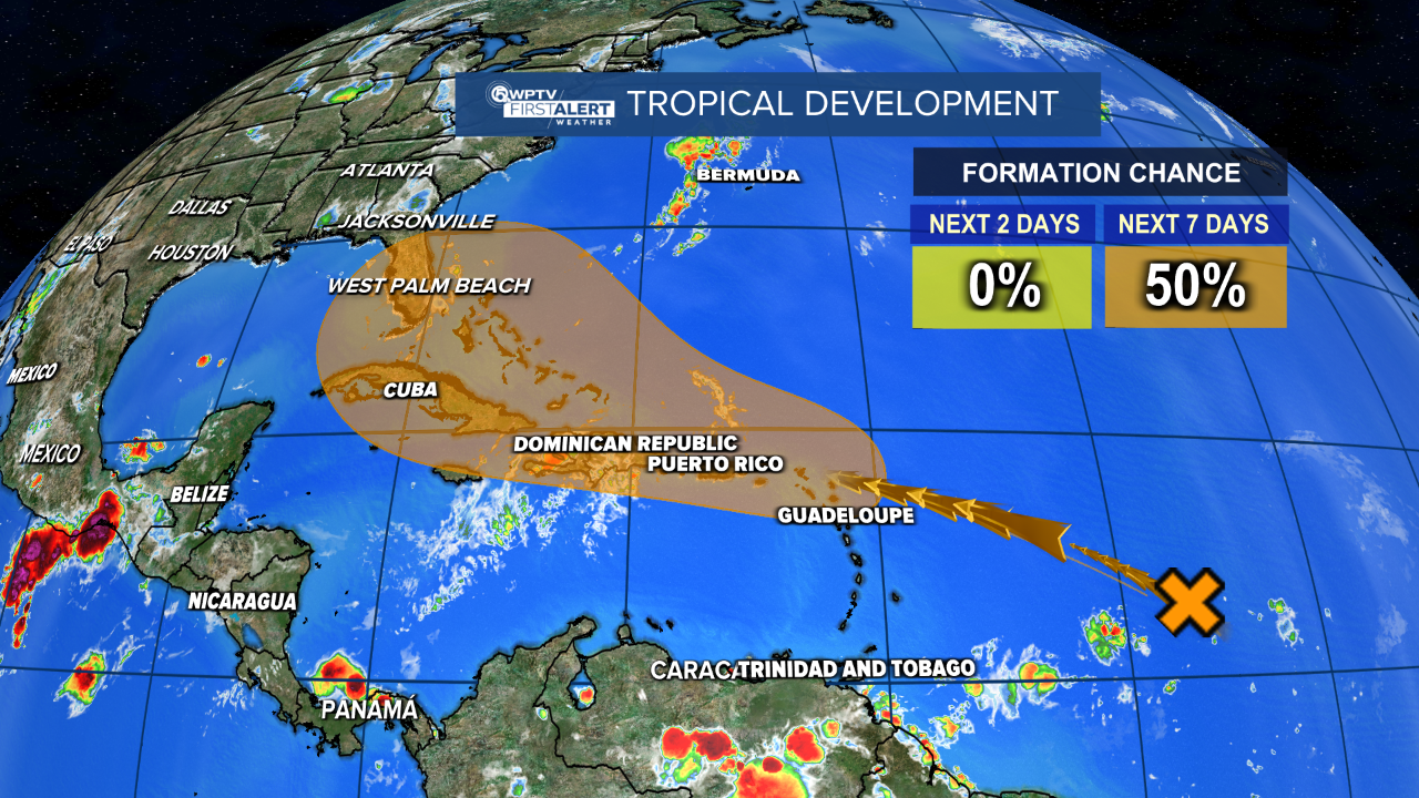
WEST PALM BEACH, Fla. — A tropical wave located in the central Atlantic Ocean has a medium chance for development this week.
WPTV First Alert Weather meteorologist Steve Weagle said the area of unsettled weather is expected to move into a more conducive environment for some development over the next several days. Still lots of uncertainty with some models taking it east of Florida and others bringing a weak rainmaker into the Gulf.
It currently has a 50% chance of development over the next seven days, and a tropical depression could form between mid to late week while the system moves closer to the Leeward Islands or the southeastern Bahamas.

MORE WEATHER: Radar | Alerts | 7-Day Forecast | Hourly Forecast
Although there is a lot of uncertainty, Correa said it's still something to watch as it could bring tropical downpours to South Florida and the Treasure Coast during the upcoming weekend.
"This could be a rainmaker for us later on in the upcoming weekend," Correa said.
In an Instagram post on Sunday, WPTV First Alert Weather meteorologist James Wieland said not all the computer models are showing tropical development with this system.
Wieland said the European model is showing the most development, and that track pulls it north sooner, keeping the system east of the Bahamas.
"If it strengthens and pulls to our east, well then we may not see as much [rain], as most of the moisture will stay east of the Bahamas," Wieland said.
The GFS American model is showing very little development, but keeps the weaker system through the Florida Straits, Florida Keys, and eventually into the Gulf of Mexico.
"If it stays a weak system, we're gonna get an increased chance of some rain here as that thing slides down to our south and into the Gulf," Wieland said. "Still a lot of uncertainty with this, as it's about a week or so away."


