
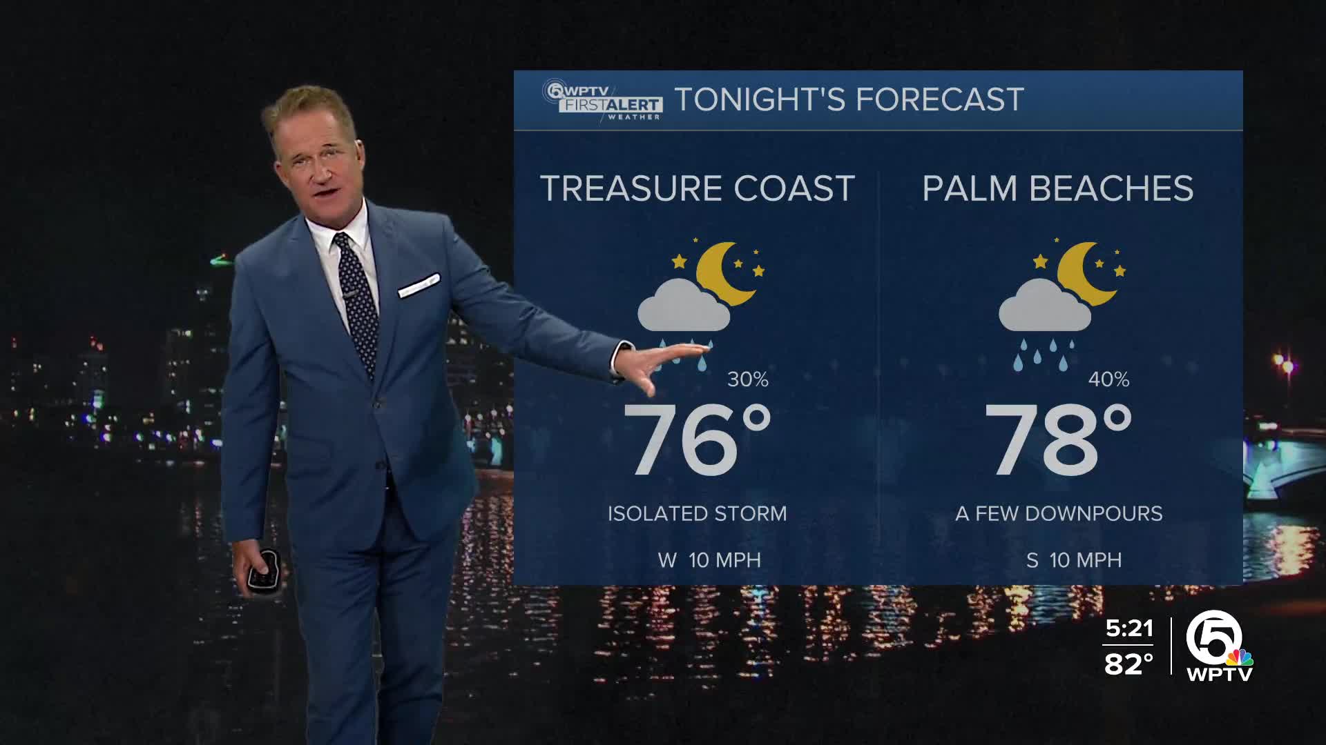


WEST PALM BEACH, Fla. — Temperatures will stay warm and muggy tonight with most of our shower and storm activity ending by mid-late evening.
Overnight lows will range from the mid-70s inland to the upper 70s to near 80 at the coast.
Deep moisture hangs around for the weekend as we have a front stalled to our north. On Saturday, a trough associated with the remnants of Francine moves through our area bringing us a 50% to 60% chance of storms.
MORE WEATHER: Radar | Alerts | 7-Day Forecast | Hourly Forecast
Most of the storms will occur in the early afternoon through early evening and will develop along sea breeze boundaries.
Boating looks good for Saturday with seas running 2 feet or less. By Sunday afternoon however, a north swell will build down the coast with seas picking up to 4-6ft.

Sunday will have slightly less rain around, but still expect scattered showers and storms in the afternoon. Highs in the low 90s.
The tropics stay active with Tropical Storm Gordon in the eastern Atlantic. Right now models curve the system north well before reaching the Caribbean Islands.
There are two other tropical waves we're watching. Neither of them poses a threat to Florida.


